
Overview
Previous Year UPSC-CSE Questions By the end you will be able to draft model answers for the following UPSC questions. Each question carries a collapsible framework showing how to approach it in the exam.
- Prelims 2016Which of the following is/are tributary/tributaries of Brahmaputra?
- Dibang
- Kameng
- Lohit
Select the correct answer using the code given below:
How to approach this Prelims question
Approach: Verify each named river: Dibang is a left-bank tributary of the Siang that joins the Brahmaputra at Sadiya (correct). Kameng (Bhareli) rises in Arunachal Pradesh and joins near Tezpur (correct). Lohit joins the Siang at Sadiya (correct). All three are tributaries.
Trap to watch: Kameng under its alternative name Bhareli is sometimes treated as a distinct river and misattributed; the two names refer to the same river.
Key facts to recall:
- Dibang joins Siang at Sadiya.
- Kameng / Bhareli joins near Tezpur.
- Lohit joins Siang at Sadiya.
- All three are confirmed Brahmaputra tributaries.
Answer signal: All three tributaries are correct (option d).
- Prelims 2017With reference to river Teesta, consider the following statements:
- The source of river Teesta is the same as that of Brahmaputra but it flows through Sikkim.
- River Rangeet originates in Sikkim and it is a tributary of river Teesta.
- River Teesta flows into Bay of Bengal on the border of India and Bangladesh.
Which of the statements given above is/are correct?
How to approach this Prelims question
Approach: Statement 1 is incorrect: the Teesta rises at the Tso Lhamo lake in northern Sikkim, NOT at the Tsangpo source. Statement 2 is correct: the Rangeet rises in Sikkim and joins the Teesta near Melli. Statement 3 is incorrect: the Teesta joins the Brahmaputra in Bangladesh, it does NOT flow directly into the Bay of Bengal.
Trap to watch: Statement 3 sounds plausible because the Brahmaputra ultimately reaches the Bay; the question tests whether the Teesta itself reaches the Bay directly. It does not.
Key facts to recall:
- Teesta source: Tso Lhamo lake in northern Sikkim, not the Tsangpo source.
- Rangeet rises in Sikkim and joins the Teesta near Melli.
- Teesta joins the Brahmaputra in Bangladesh, not the Bay of Bengal directly.
Answer signal: Only Statement 2 is correct (option b).
- Prelims 2014Consider the following rivers:
- Barak
- Lohit
- Subansiri
Which of the above flows/flow through Arunachal Pradesh?
How to approach this Prelims question
Approach: Barak does NOT flow through Arunachal Pradesh; it rises in Manipur and flows through Manipur, Mizoram, and southern Assam (Statement 1 incorrect). Lohit flows through Arunachal Pradesh before joining the Siang at Sadiya (Statement 2 correct). Subansiri flows through Arunachal Pradesh from its Tibetan headwaters to its Brahmaputra confluence (Statement 3 correct).
Trap to watch: Barak's classification under the Brahmaputra Board creates confusion; the Board's jurisdiction covers both systems but the Barak itself does not flow through Arunachal Pradesh.
Key facts to recall:
- Barak rises in Manipur, flows through Manipur, Mizoram, southern Assam, not Arunachal.
- Lohit flows through Arunachal Pradesh; joins Siang at Sadiya.
- Subansiri rises in Tibet, flows through Arunachal Pradesh.
Answer signal: Lohit and Subansiri only (option b).
- UPSC Mains 2013 GS-IIConstitutional mechanisms to resolve the inter- state water disputes have failed to address and solve the problems. Is the failure due to structural or process inadequacy or both? Discuss.
How to structure the answer in the exam
Introduction: Article 262 of the Constitution empowers Parliament to adjudicate inter-state river water disputes through the Inter-State River Water Disputes Act 1956 and subsequent tribunals. The mechanism has produced awards on the Cauvery, the Krishna, the Godavari, and other basins, but is widely regarded as having failed to deliver durable settlements.
Conclusion: Both structural and process inadequacies contribute to the failure of constitutional mechanisms on inter-state water disputes; reform requires a permanent inter-state water tribunal with binding awards and time-bound process plus a Centre-state integrated water-resource framework that accommodates climate-driven flow shifts.
What the Brahmaputra and Northeast Drainage Cover
The Brahmaputra Trunk and the Independent Barak System
The Brahmaputra and Northeast drainage covers two distinct river systems within the Indian Northeast. The Brahmaputra trunk rises on the Tibetan plateau as the Yarlung Tsangpo, makes the famous Great Bend at Namcha Barwa, enters Arunachal Pradesh as the Siang, and takes the name Brahmaputra after the confluence with the Lohit and Dibang near Sadiya.
The independent Barak system rises in Manipur, crosses Mizoram and southern Assam, and bifurcates in Bangladesh into the Surma and the Kushiyara before joining the Meghna. Together the two systems drain almost the entire Indian Northeast and form the third great Himalayan basin alongside the Indus and the Ganga.
The Brahmaputra carries an average discharge of about twenty-two thousand cubic metres per second that rises to nearly one hundred and three thousand cubic metres per second at flood peaks. The river is the largest single contributor to the Ganges-Brahmaputra-Meghna delta sediment load covered in Part 8.
The Assam reach hosts a vast braided floodplain, the world's largest inland river island at Majuli, and a flood regime that affects roughly one-and-a-half lakh hectares of cropland in a typical year. Northeast India's strategic geography is therefore inseparable from the geography of its rivers.
Why the Northeast Drainage Is Treated as a Single Topic
What is the significance of the Brahmaputra-Northeast drainage for Indian geography. Four distinct phenomena make the basin uniquely consequential. First, the trunk Brahmaputra is the only major Indian river that enters from the east, crosses Arunachal and Assam latitudinally, and exits south into Bangladesh. Second, the braided floodplain in Assam is among the broadest in the world, with banks more than eight kilometres apart in the rains, and produces annual flooding that no embankment regime has solved.
Third, the basin is the most climate-exposed of the three great Himalayan rivers, owing to glacier loss in Tibet, intensifying monsoon rainfall, and increasing glacial-lake outburst flood events. Fourth, the trans-boundary dimension involves both China upstream (the recent Medog hydropower decision) and Bangladesh downstream (Meghna integration), without any treaty of the Indus or Ganga style.
| Attribute | Value | Source |
|---|---|---|
| Brahmaputra average annual discharge | About 22,000 m³/s | Wikipedia Brahmaputra |
| Brahmaputra peak flood discharge | About 103,000 m³/s | Wikipedia Brahmaputra |
| Brahmaputra average depth (Assam) | 30 m; max 135 m at Sadiya | Wikipedia Brahmaputra |
| Braided floodplain width (Assam) | Banks more than 8 km apart in the rains | Wikipedia Brahmaputra |
| Channel migration rate (recent record) | About 30 m per year (down from 150 m per year 1973-1992) | Wikipedia Brahmaputra |
| Yarlung Tsangpo length in Tibet | About 1,125 km | Wikipedia Yarlung Tsangpo |
| Majuli area (2024) | About 880 km² (down from 1,300 km² in 1790s) | Wikipedia Majuli |
| Barak length in India | About 524 km; source at Liyai Kullen 987 m, Manipur | Wikipedia Barak River |
| Subansiri length | About 518 km from Tibet headwaters | Wikipedia Subansiri River |
The Yarlung Tsangpo, the Great Bend, and the Dihang Entrance into India
Tibet Reach Before the Great Bend
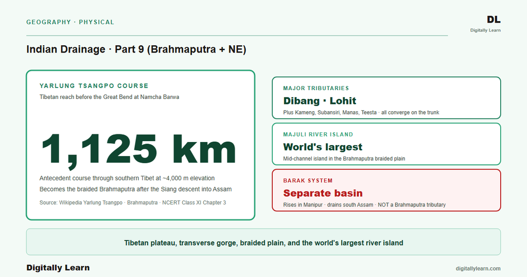
The Yarlung Tsangpo rises on the southern slopes of the Kailash range covered in Part 4 of this series, and runs east across the southern Tibetan plateau for about one thousand one hundred and twenty-five kilometres. The course parallels the main Himalayan axis at an elevation between three and five thousand metres throughout this reach.
The river accepts numerous Tibetan tributaries and grows in volume as it crosses Lhasa Prefecture and Lhokha Prefecture toward the eastern syntaxis of the Himalayas, where the Great Bend begins.
The Tsangpo's antecedent character is the same as that of the Indus and the Sutlej covered in Part 4 of this series. The river predates the Himalayan uplift and has maintained its eastward course by vertical incision as the land rose around it. The Tibetan reach is therefore not merely a geographic curiosity but the upstream half of one of the world's three classic antecedent river systems.
The Great Bend at Namcha Barwa and Entrance as the Siang
At the eastern syntaxis of the Himalayas the Tsangpo makes the Great Bend around the Namcha Barwa massif, turning sharply south through what is reckoned the deepest and possibly longest canyon in the world. The canyon walls rise five thousand metres and more on each side between Gyala Peri and Namcha Barwa. The river then descends rapidly through the Dihang gorge and enters India at the Arunachal Pradesh frontier.
Inside India the river is known as the Siang until it is joined by the Dibang from the north and the Lohit from the east near Sadiya. Below Sadiya the combined river takes the name Brahmaputra and continues west across the Assam plain. The Dihang-Dibang-Lohit triple confluence at Sadiya is the formal birthplace of the Brahmaputra as a named river within India, parallel to the Bhagirathi-Alaknanda confluence at Devprayag that births the Ganga.
The Assam Braided Floodplain and the Majuli River Island
Why the Brahmaputra Braids Across the Assam Plain
The Brahmaputra in its Assam reach is the textbook example of a braided river covered in Part 5 of this series. Three structural conditions sustain the pattern. Heavy bedload from the Himalayan front (coarse sand and gravel) cannot be held in solution and is deposited as mid-channel bars. Steep gradient between the Siwalik foothills and the Bangladesh border keeps the river energetic enough to rework its bed every monsoon.
High discharge variability between the lean dry season and the monsoon peak forces the river to switch channels repeatedly. The result is a braided plain whose banks are more than eight kilometres apart in the rains across parts of Assam.
Channel migration in the Brahmaputra is among the fastest documented for any major river. Recent measurements record channel migration at about thirty metres per year, down from one hundred and fifty metres per year between 1973 and 1992. The migration is fastest where the river is widest and where erodible silt-bank material is exposed. The flood-management apparatus covered in Section 5 must continually rebuild embankments displaced by the migrating channel.
Majuli as a Shrinking Record of Channel Migration
Observable outcome (c). Majuli is the world's largest inland river island by Guinness World Records and the only island ever designated as a district in India (created in 2016). The island sits in the middle of the Brahmaputra in upper Assam, bordered by the Subansiri to the north and the Brahmaputra to the south.
Majuli's area has shrunk over two centuries from about one thousand three hundred square kilometres in the 1790s to roughly eight hundred and eighty square kilometres in 2024. Continuous bank erosion drives the loss, and the island remains a national-priority conservation case.
Majuli is also a centre of Assamese Vaishnavite culture, with several historic satras (monasteries) founded by Srimanta Sankardev in the fifteenth and sixteenth centuries. The island has been on the UNESCO World Heritage Tentative List since March 2004 under the cultural category. The dual significance of Majuli, hydrological as well as cultural, makes its erosion a national-priority conservation issue and a recurring theme in Brahmaputra-basin management policy.
Major Tributaries of the Brahmaputra and the Independent Barak System
Right-Bank and Left-Bank Tributaries of the Brahmaputra
The Brahmaputra accepts a series of substantial tributaries across the Assam plain, broadly grouped by bank. The north-bank tributaries rise on the southern Himalayan slopes of Arunachal Pradesh, Bhutan, and Sikkim, and feed the river from the right as one looks downstream.
- Subansiri: Rises in Tibet and runs about five hundred and eighteen kilometres through Arunachal Pradesh; carries the under-construction Lower Subansiri Hydroelectric Project; the largest north-bank tributary by discharge.
- Kameng (also called Bhareli): Rises in Arunachal Pradesh and drains the Sela and Tawang ranges; joins the Brahmaputra near Tezpur in Assam.
- Manas: Rises in Bhutan and drains the southern Bhutan ranges; the Manas National Park sits on the Indian bank of the river; UPSC Prelims questions have repeatedly anchored on the Manas-Brahmaputra link.
- Sankosh: Rises in northern Bhutan and joins the Brahmaputra at the Assam-West Bengal border; one of the proposed nodes of the National River Linking Project.
The south-bank tributaries rise on the Patkai and Naga ranges in the south-east and feed the Brahmaputra from the left. The first two, the Dibang and the Lohit, join the Siang near Sadiya to form the Brahmaputra. The Dhansiri drains north-east Assam toward Golaghat; the Burhi Dihing drains east-central Assam toward Dibrugarh. UPSC Prelims of 2016 confirmed that the Dibang, the Kameng, and the Lohit are all tributaries of the Brahmaputra.
The Barak System and the Surma-Kushiyara Bifurcation
The Barak river is the second great Northeast Indian river system and runs independently of the Brahmaputra. The river rises at Liyai Kullen village in Senapati district of Manipur at an elevation of nine hundred and eighty-seven metres. The Barak runs about five hundred and twenty-four kilometres in India through Manipur, Mizoram, and southern Assam (Cachar district), before entering Bangladesh.
On entering Bangladesh the Barak bifurcates into the Surma and the Kushiyara rivers, which converge again downstream to form the Meghna. The Meghna then joins the combined Ganges-Brahmaputra distributary system in the eastern delta. The Indian Barak reach was designated as National Waterway 16 in 2016, with a navigable stretch of about one hundred and twenty-one kilometres between Lakhipur and Bhanga.
UPSC Prelims of 2014 confirmed that the Barak does not flow through Arunachal Pradesh; among the three rivers Barak, Lohit, and Subansiri, only the Lohit and the Subansiri flow through Arunachal.
Annual Assam Floods, the Brahmaputra Board, and the Trans-Boundary Frame
Why the Brahmaputra Floods Every Year and How India Manages It
The Brahmaputra produces annual flooding in Assam through three reinforcing mechanisms. Monsoon discharge swells the trunk from twenty-two thousand to more than one hundred thousand cubic metres per second within weeks. Channel aggradation from the heavy sediment load (covered in Part 5 of this series) raises the riverbed relative to the surrounding plain.
Embankment-induced sediment trapping accelerates the aggradation, so each successive flood overtops larger areas than the last. The combined result is that roughly one-and-a-half lakh hectares of cropland is affected by Brahmaputra floods in a typical year.
The institutional response is the Brahmaputra Board, a statutory body established in 1980 under the Ministry of Water Resources to coordinate flood management, basin planning, and embankment maintenance across the entire Indian Brahmaputra basin and the Barak system. The Board operates alongside the Assam State Disaster Management Authority and the Central Water Commission regional offices. Recent strategies have shifted from pure embankment maintenance toward floodplain reactivation, retreat-and-rebuild policy for vulnerable settlements, and integrated coastal-fluvial planning along the Bangladesh outflow.
Tsangpo Hydropower, Bangladesh Outflow, and Climate Vulnerability
The Brahmaputra basin is the only one of India's three great Himalayan rivers without a comprehensive bilateral water-sharing treaty. The Sino-Indian dimension is governed by an Expert Level Mechanism established in 2006 and by hydrological data-sharing agreements. The India-Bangladesh dimension is governed by ad-hoc bilateral consultations rather than a 1996-style Ganges Water Treaty. The absence of a formal treaty framework leaves the basin uniquely exposed to upstream Chinese decisions.
The most consequential recent decision is the Medog Hydropower Station on the Yarlung Tsangpo. China approved the project in December 2024 and construction officially commenced on 19 July 2025 at a project cost of approximately one trillion yuan.
The Medog project is intended to be the world's largest hydropower dam and sits near the Great Bend, where the Tsangpo descends through the deepest canyon in the world. Indian concerns centre on possible disruption to downstream sediment and seasonal flow for the Brahmaputra and the Assam floodplain.
Climate change intersects with all of the above. Glacier loss on the Tibetan plateau (covered in Parts 4 and 5) reduces the dry-season buffer that the Brahmaputra depends on, while intensifying monsoon rainfall amplifies the peak floods.
Increasing glacial-lake outburst floods from the higher Himalayas, including the October 2023 Sikkim South Lhonak GLOF that destroyed the Teesta Stage III dam, have added a new flood category to basin-management planning. Parts 10 to 15 of this series turn to the Peninsular drainage and the closing parts on floods, pollution, and river-linking governance.
Prelims MCQ practice
Each question below tests one specific concept on the topic. Click to reveal the answer and a full option-wise explanation.
Q1. Consider the following statements about the major tributaries of the Brahmaputra:
- The Subansiri rises in Tibet and is the largest north-bank tributary of the Brahmaputra by discharge.
- The Dibang and the Lohit join the Siang at Sadiya to form the Brahmaputra proper.
- The Manas rises in Bhutan and gives its name to the Manas National Park on the Indian bank.
Which of the statements given above are correct?
- 1 only
- 1 and 2 only
- 2 and 3 only
- 1, 2 and 3
Show answer and explanation
Answer: 1, 2 and 3
Explanation.
All three statements are correct: Subansiri from Tibet as the largest north-bank tributary, Dibang and Lohit joining the Siang at Sadiya, and the Manas-Bhutan-Manas National Park linkage.
Q2. Consider the following statements about Majuli island:
- Majuli is recognised by Guinness World Records as the world's largest inland river island.
- Majuli was the first island in India to be designated as a district, in 2016.
- The area of Majuli has remained stable at about one thousand three hundred square kilometres since the 1790s.
Which of the statements given above are correct?
- 1 only
- 1 and 2 only
- 2 and 3 only
- 1, 2 and 3
Show answer and explanation
Answer: 1 and 2 only
Explanation.
Statements 1 and 2 are correct. Statement 3 is incorrect: Majuli has shrunk from about one thousand three hundred square kilometres in the 1790s to about eight hundred and eighty square kilometres in 2024 through continuous erosion.
Q3. Consider the following statements about the Yarlung Tsangpo and its course into India:
- The Yarlung Tsangpo runs about one thousand one hundred and twenty-five kilometres across the Tibetan plateau before turning south at the Great Bend.
- The Great Bend is located at the Namcha Barwa massif at the eastern Himalayan syntaxis.
- Once the river enters Arunachal Pradesh through the Dihang gorge it is known as the Siang until the confluence with the Dibang and the Lohit at Sadiya.
Which of the statements given above are correct?
- 1 only
- 1 and 2 only
- 2 and 3 only
- 1, 2 and 3
Show answer and explanation
Answer: 1, 2 and 3
Explanation.
All three statements are correct: 1,125 km in Tibet, Great Bend at Namcha Barwa, called Siang in Arunachal Pradesh until the Sadiya triple-confluence.
Q4. Consider the following statements about the Barak river system:
- The Barak rises at Liyai Kullen village in Senapati district of Manipur.
- On entering Bangladesh the Barak bifurcates into the Surma and the Kushiyara before joining the Meghna.
- The Indian reach of the Barak was designated as National Waterway 16 in 2016 with a navigable stretch between Lakhipur and Bhanga.
Which of the statements given above are correct?
- 1 only
- 1 and 2 only
- 2 and 3 only
- 1, 2 and 3
Show answer and explanation
Answer: 1, 2 and 3
Explanation.
All three statements are correct: source at Liyai Kullen in Senapati district at 987 m elevation, Bangladesh bifurcation into Surma and Kushiyara then Meghna confluence, and National Waterway 16 designation in 2016 with about 121 kilometres between Lakhipur and Bhanga.
Q5. Consider the following statements about Brahmaputra flood management and trans-boundary cooperation:
- The Brahmaputra Board was established in 1980 under the Ministry of Water Resources as the statutory body for basin-level flood management.
- The Sino-Indian dimension of Brahmaputra cooperation operates through an Expert Level Mechanism established in 2006 rather than a formal water-sharing treaty.
- The Medog Hydropower Station on the Yarlung Tsangpo was approved by China in December 2024.
Which of the statements given above are correct?
- 1 only
- 1 and 2 only
- 2 and 3 only
- 1, 2 and 3
Show answer and explanation
Answer: 1, 2 and 3
Explanation.
All three statements are consistent with the institutional record: Brahmaputra Board established 1980, Sino-Indian Expert Level Mechanism since 2006, and the December 2024 Chinese approval of the Medog Hydropower Station on the Tsangpo.
Sources
- India Physical Environment, Class 11, Chapter 3: Drainage System
- Brahmaputra River
- Yarlung Tsangpo
- Majuli
- Barak River
- Subansiri River
- Teesta River
- Brahmaputra basin annual reports
- Tectonic Atlas of India and Brahmaputra valley field memoirs
- National Mission for Sustaining the Himalayan Ecosystem
- Sino-Indian Expert Level Mechanism on trans-boundary rivers
- Brahmaputra Board and Northeast water governance releases
Disclaimer
This article draws on NCERT and the Wikipedia primary articles on the Brahmaputra, the Yarlung Tsangpo, the Barak, the Subansiri, Majuli, and the Teesta. The numerical claims on river lengths, source elevations, channel migration rates, and project status are cited from those primary sources. Readers seeking the operational architecture of flood governance should consult the Ministry of Jal Shakti and Central Water Commission portals.


