
Overview
Previous Year UPSC-CSE Questions By the end you will be able to draft model answers for the following UPSC questions. Each question carries a collapsible framework showing how to approach it in the exam.
- Prelims 2016Which of the following are the key features of ‘National Ganga River Basin Authority (NGRBA)’?
- River basin is the unit of planning and management.
- It spearheads the river conservation efforts at the national level.
- One of the Chief Ministers of the States through which the Ganga flows becomes the Chairman of NGRBA on rotation basis. Select the correct answer using the code given below:
How to approach this Prelims question
Approach: Statement 1 is TRUE: NGRBA adopted river-basin as the unit of planning, a fundamental shift from the earlier town-wise GAP model. Statement 2 is TRUE: NGRBA was the national-level coordinating authority for Ganga conservation when it was constituted in 2009. Statement 3 is FALSE: the Chairman of NGRBA was the Prime Minister (not a rotating state Chief Minister); the Chief Ministers of the Ganga-basin states were members of NGRBA but did not chair on rotation.
Trap to watch: Statement 3 plausibly inverts the typical inter-state coordinating-body pattern. NGRBA broke that pattern by placing the PM at the top.
Key facts to recall:
- NGRBA constituted 2009 under the Environment Protection Act 1986.
- Chairman: Prime Minister.
- Members: Union Ministers along with Chief Ministers of Ganga-basin states.
- Replaced by NMCG via the 2016 Authorities Order.
Answer signal: Statements 1 and 2 correct only (option a).
- Prelims 2018How is the National Green Tribunal (NGT) different from the Central Pollution Control Board (CPCB)?
- The NGT has been established by an Act whereas the CPCB has been created by an executive order of the Government.
- The NGT provides environmental justice and helps reduce the burden of litigation in the higher courts whereas the CPCB promotes cleanliness of streams and wells, and aims to improve the quality of air in the country.
Which of the statements given above is/are correct?
How to approach this Prelims question
Approach: Statement 1 is FALSE: BOTH NGT (NGT Act 2010) and CPCB (Water Act 1974) were established by Acts of Parliament. CPCB was not created by executive order. Statement 2 is TRUE: NGT does adjudicate environmental disputes under the 2010 Act, and CPCB does promote cleanliness of streams, wells, and air quality under the 1974 Water Act and the 1981 Air Act.
Trap to watch: Statement 1 plausibly sounds correct because many regulatory bodies are created by executive order; here both were established by statute.
Key facts to recall:
- NGT: National Green Tribunal Act 2010.
- CPCB: Water (Prevention and Control of Pollution) Act 1974.
- Both statutory, not executive.
- Different functions: NGT adjudicates, CPCB monitors and standards.
Answer signal: Statement 2 only (option b).
- Prelims 2014Consider the following pairs : Wetlands – Confluence of rivers
- Harike Wetlands : Confluence of Beas and Satluj/Sutlej
- Keoladeo Ghana National Park : Confluence of Banas and Chambal
- Kolleru Lake : Confluence of Musi and Krishna
Which of the above pairs is/are correctly matched?
How to approach this Prelims question
Approach: Pair 1 is CORRECT: Harike Wetlands sit at the confluence of the Beas and the Sutlej near Harike in Punjab (Part 6 of this series). Pair 2 is INCORRECT: Keoladeo Ghana National Park is in Bharatpur, Rajasthan; it is not at the confluence of the Banas and the Chambal but is a man-made wetland fed by canals from the Ajan Bund. Pair 3 is INCORRECT: Kolleru Lake lies between the Krishna and the Godavari deltas in Andhra Pradesh; it is not at any river confluence and certainly not Musi-Krishna.
Trap to watch: Wetlands and rivers are easy to mismatch under exam pressure. Anchor each to its source state and feeding-river system.
Key facts to recall:
- Harike Wetlands: Beas plus Sutlej confluence, Punjab (Ramsar site since 1990).
- Keoladeo Ghana NP: Bharatpur, Rajasthan; not a river confluence.
- Kolleru Lake: between Krishna and Godavari deltas in Andhra Pradesh.
- Chilika: Odisha brackish lagoon, Ramsar since 1981.
Answer signal: Pair 1 only is correctly matched (option a).
- UPSC Mains 2015 GS-IIIDiscuss the Namami Gange and National Mission for Clean Ganga (NMCG) programmes and causes of mixed results from the previous schemes. What quantum leaps can help preserve the river Ganga better than incremental inputs?
How to structure the answer in the exam
Introduction: The Namami Gange Programme launched in 2014 with an initial allocation of approximately Rs.20,000 crore represents a basin-wide approach to Ganga conservation, succeeding the town-centric GAP-I (1985) and GAP-II (1996). The National Mission for Clean Ganga was reconstituted as an Authority in October 2016 via the River Ganga (Rejuvenation, Protection and Management) Authorities Order 2016.
Conclusion: Namami Gange has shifted Indian river-conservation policy from town-centric to basin-wide, and the NMCG 2016 statutory reconstitution gives it institutional permanence. Realising the programme's promise requires moving beyond infrastructure outlay to enforcement, decentralisation, tributary inclusion, and climate-resilient design as the quantum leaps identified in this answer.
- UPSC Mains 2020 GS-IHow will the melting of Himalayan glaciers have a far- reaching impact on the water resources of India?
How to structure the answer in the exam
Introduction: Himalayan glacier retreat is the most directly observable climate-change signal on Indian water resources. The Gangotri Glacier source of the Bhagirathi has retreated approximately 1,147 metres between 1936 and 1996, Sikkim glaciers retreat at about 13 metres per year, and the Greater Himalayan average is 18 to 20 metres per year. Indian water resources will be reshaped by this retreat in three far-reaching ways.
Conclusion: Himalayan glacier retreat is the master pressure that conditions Indian water-resource planning for the twenty-first century. The institutional architecture from CPCB to NMCG must integrate climate adaptation alongside its existing pollution-and-conservation remit, or the inheritance from Parts 1 to 14 of this series will be overtaken by the climate signal.
Indian Rivers as a Climate-Sensitive System
What This Article Synthesises
The Indian drainage system is the integrated network of Himalayan and Peninsular rivers that this fifteen-part series has traced from foundation through evolution to economy and governance. Every dimension of that system, from the monsoon-pulse floods of the Indo-Gangetic plain to the pollution governance of the Ganga and the climate-driven retreat of the Gangotri glacier, sits inside the same physical-and-policy envelope.
This concluding article applies the inheritance of the earlier parts to four parallel pressures that act on the same river network at once: floods, pollution, conservation, and climate change.
The fourteen earlier parts of this series establish the static and historical drainage system, from foundation through evolution to economy and governance. Recalling that inheritance in brief shows how much groundwork the four pressures now act upon.
- Parts 1 to 5 covered the foundation and the Himalayan river characteristics.
- Parts 6 to 9 traced the Indus, the Ganga, and the Brahmaputra systems.
- Parts 10 to 12 covered the Peninsular East-flowing and West-flowing systems.
- Part 13 covered riverine landforms, deltas, and estuaries.
- Part 14 covered the economy of drainage, the National River Linking Project, and the inter-state tribunal architecture.
This article applies that full inheritance to the four contemporary pressures. The reason is direct: every policy decision the Indian republic makes about its rivers in the coming decades will be made under climate stress.
Why the Four Pressures Belong in One Frame
What is the significance of treating floods, pollution, conservation, and climate as a single frame. The four pressures interact through one physical river network and one institutional governance stack. Floods mobilise sediment and dilute pollution but also destroy treatment plants. Pollution accumulates in low-flow periods and worsens when reservoir releases are mistimed.
Conservation programmes such as Namami Gange and the National River Conservation Plan address the pollution stock, while flood-management programmes address the flow extremes. Climate change shifts the underlying distribution of monsoon flows, glacier melt, and sea-level rise; it is the master pressure that conditions the other three.
| Pressure | Lead institution | Headline metric |
|---|---|---|
| Floods | National Disaster Management Authority (NDMA, 2005) | Approximately 40 Mha flood-prone area |
| Pollution | Central Pollution Control Board (CPCB, 1974) | 1,019 water-quality monitoring stations |
| Conservation | National Mission for Clean Ganga (NMCG, 2016) | Namami Gange Rs.20,000 crore (2014) |
| Climate change | MoEFCC plus IPCC AR6 and ICIMOD HKH outputs | Gangotri retreat 1,147 m (1936 to 1996) |
Indian River Floods Regime and Management
Monsoon-Pulse Flood Regime Across Indian Basins
Floods are the most common natural disaster in India. The Rashtriya Barh Ayog (National Flood Commission) estimated in 1980 that about forty million hectares of the country are flood-prone, roughly an eighth of the total geographical area. The flood regime is dominated by the summer southwest monsoon, which delivers about three-quarters of annual rainfall in a four-month pulse from June to September.
The basins divide by source signature. The Himalayan basins (Parts 5 to 9) carry combined snowmelt and monsoon flows. The Peninsular basins (Parts 10 to 12) carry monsoon-pulse flows with a northeast-monsoon cyclone overlay in October and November.
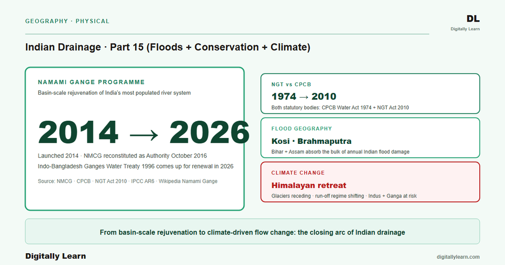
Specific flood events mark the historical record. The 2013 North Indian floods caused more than five thousand seven hundred presumed deaths in Uttarakhand and Himachal Pradesh, the deadliest river-flood disaster in recent Indian memory. The 1987 Bihar flood on the Kosi claimed one thousand three hundred and ninety-nine lives, and the 2008 Kosi avulsion shifted the river's main channel about one hundred and twenty kilometres east (covered in Part 7).
Urban floods are the rising signal. The Mumbai 2005 floods, the Chennai 2015 deluge, the Hyderabad 2020 floods, and the Bengaluru 2022 floods together illustrate how drainage failure in fast-growing cities compounds the climate-change flood signal.
- Brahmaputra basin: braided channels and bank erosion across the Assam valley (Part 9).
- Kosi-Gandak basin: Himalayan sediment overload and channel avulsion in north Bihar (Part 7).
- Mahanadi and Godavari deltas: cyclone-driven backwater flooding on the east coast (Part 10).
- West-coast urban plains: intense short-duration rainfall over Mumbai and other coastal cities.
The institutional architecture of flood management rests on the National Disaster Management Authority (NDMA), constituted under the Disaster Management Act 2005. The NDMA coordinates the National Disaster Response Force and issues flood advisories with the Central Water Commission and the India Meteorological Department.
Basin-specific flood control is more local. It rests with state-level Water Resources Departments, the Ganga Flood Control Commission for the Ganga basin, and the Brahmaputra Board for the Northeast. Their combined remit covers flood-warning issuance, response-force deployment, and post-event relief and rehabilitation.
Indian River Pollution and the CPCB Monitoring Framework
Central Pollution Control Board Monitoring Infrastructure
The Central Pollution Control Board (CPCB) was established in 1974 under the Water (Prevention and Control of Pollution) Act 1974. It administers a nationwide water-quality monitoring network of 1,019 stations across twenty-seven States and six Union Territories. The network covers 200 rivers, sixty lakes, and a long tail of tanks, ponds, creeks, canals, drains, and wells.
The monitoring cycle is quarterly for surface waters and half-yearly for groundwater. The CPCB also runs the National Air Quality Monitoring Programme (NAMP), the Monitoring of Indian National Aquatic Resources System (MINARS), and the Yamuna Action Plan in coordination with state pollution control boards.
Two case studies frame the pollution picture. The Ganga at Varanasi carries faecal coliform bacteria at concentrations more than one hundred times the official Indian limit. The Yamuna at Delhi receives about eight hundred million litres of largely untreated sewage and a further forty-four million litres of industrial effluents each day, as of 2019.
The geography is concentrated. The twenty-two kilometre Delhi barrage stretch is less than two per cent of the Yamuna's length but accounts for nearly eighty per cent of the river's total pollution. Such concentration makes the case for basin-wide rather than stretch-wise pollution governance.
Sources of River Pollution and Mitigation Architecture
The sources of Indian river pollution fall into three categories. Domestic sewage is the largest single source: Indian cities and towns generate roughly seventy thousand million litres a day, of which only about half is treated and the rest discharged into rivers.
Industrial effluents from tanneries (Kanpur on the Ganga), thermal power, sugar, paper, chemical, and pharmaceutical plants add high-BOD, heavy-metal, and toxic-organic loads. Agricultural runoff carries nitrate, phosphate, and pesticide residues from fertilised croplands into rivers and groundwater.
The mitigation architecture rests on the National Green Tribunal (NGT) and the Central Pollution Control Board working in parallel. The distinction is precise: the NGT was set up by an Act of Parliament, the National Green Tribunal Act 2010, for environmental adjudication, while the CPCB was set up under the 1974 Water Act for pollution monitoring and standards enforcement.
Together they form the administrative backbone of Indian water-pollution governance. The 1974 Water Act predates the 1986 Environment (Protection) Act, yet it remains the foundational statute for the regulation of water quality in India.
Namami Gange Programme and the National Mission for Clean Ganga
Ganga Action Plan 1985 to Namami Gange 2014
The Indian river-conservation effort has evolved through four generations, moving steadily from a town-by-town clean-up to a basin-wide statutory mission.
- Ganga Action Plan (June 1985): launched by Prime Minister Rajiv Gandhi, the earliest centralised pollution-abatement plan. GAP-I covered twenty-five Class I towns across three states with an allocation of Rs.862.59 crore.
- Yamuna Action Plan (1993): implemented by the Ministry of Environment and Forests through the National River Conservation Directorate.
- GAP-II (1996): expanded the Ganga effort to fifty-nine towns across five states, with a larger multi-crore allocation. GAP-I had delivered unsatisfactory results, which prompted the redesign that became Namami Gange.
- Namami Gange (2014): the basin-wide programme described below, delivered through the National Mission for Clean Ganga.
The Namami Gange Programme was launched in 2014 with an initial allocation of Rs.20,000 crore. It works through four pillars: sewage treatment infrastructure, riverfront and ghat redevelopment, river-surface cleaning with biodiversity and afforestation work, and industrial pollution monitoring.
The National Mission for Clean Ganga (NMCG) was reconstituted as the implementing Authority in October 2016 through the River Ganga (Rejuvenation, Protection and Management) Authorities Order 2016. That order dissolved the earlier National Ganga River Basin Authority and made the NMCG the implementation wing of the National Ganga Council under the Ministry of Jal Shakti, marking the shift from an advisory body to a statutory mission.
Climate Change and the Wider Conservation Architecture
Himalayan Glacier Retreat and Monsoon Variability
The climate signal on Indian drainage runs through three channels. First, Himalayan glacier retreat is reshaping the dry-season flow of the snow-fed Indus, Ganga, Yamuna, and Brahmaputra (Parts 5 to 9).
The measured retreat is large. The Gangotri Glacier, source of the Bhagirathi (Part 7), retreated about one thousand one hundred and forty-seven metres between 1936 and 1996, with roughly eight hundred and fifty metres of that in the last twenty-five years of the twentieth century. Sikkim glaciers retreated at about thirteen metres a year between 1976 and 2005, and Greater Himalayan glaciers under study average about eighteen to twenty metres a year.
Second, monsoon variability is intensifying. IPCC AR6 projections for South Asia point to more extreme-precipitation events alongside more frequent and longer monsoon breaks, raising both flood and drought risk in the same year.
Third, sea-level rise is reshaping the Sundarbans and other Indian deltas (Part 8 on the Ganga-Brahmaputra-Meghna delta and Part 10 on the Mahanadi delta). Together these three channels define the far-reaching impact of Himalayan glacier melting on Indian water resources.
Wider Conservation Architecture: NRCP, Wetlands, and Ramsar Sites
Beyond Namami Gange, the Indian river-conservation framework rests on three layers. The National River Conservation Plan (NRCP) extends the GAP approach to all major non-Ganga rivers, including the Yamuna, the Mahanadi, the Godavari, the Krishna, the Cauvery, and the Narmada (Parts 10 to 12).
The National Plan for Conservation of Aquatic Ecosystems (NPCA) merges the earlier National Wetland Conservation Programme and National Lake Conservation Plan into one MoEFCC scheme for wetlands and lakes. The Ramsar Convention, to which India has been a party since 1982, lists wetlands of international importance; India now has about ninety-nine Ramsar sites covering close to thirteen and a half lakh hectares.
Several Ramsar sites illustrate the conservation picture. Harike Wetlands sit at the confluence of the Beas and the Sutlej in Punjab (Part 6 Indus tributaries). Keoladeo Ghana National Park in Bharatpur, Rajasthan is a key bird-migration site, and Chilika Lake in Odisha is the largest brackish-water lagoon in Asia (Part 13 estuaries).
Loktak Lake in Manipur and Vembanad-Kol in Kerala (Part 13 backwaters) are other major sites. The Montreux Record within the Ramsar framework flags wetlands whose ecological character is under threat; Keoladeo and Loktak have appeared on it at various times. The wise-use principle governs how these wetlands are maintained.
Drainage Governance for the 21st Century: A Synthesis
How the Fourteen Parts Connect to a Climate-Conditioned Future
Three master pressures shape Indian drainage governance for the next decade. First, the climate signal is no longer a projection; it is here. Gangotri's 1,147-metre retreat is the visible record, and the Himalayan dry-season flows on which the Indus, the Ganga, the Yamuna, and the Brahmaputra depend will shift.
That shift unsettles old agreements. The Indus Waters Treaty (Part 6) and the inter-state tribunals (Part 14) were drafted in a climate regime that no longer holds. Second, the institutional stack from CPCB (1974) to NDMA (2005) to NMCG (2016) to the Ministry of Jal Shakti (2019) is complete on paper but uneven in execution, and the mixed-results question runs through every Namami Gange assessment cycle.
Third, the integration question ties the whole series together. Indian drainage governance for the twenty-first century needs basin-wide accounting that brings floods, pollution, conservation, and climate to one decision table. The constitutional foundation already exists: Article 21 environmental jurisprudence, Article 262 inter-state dispute resolution, the 1974 Water Act, the 1986 Environment Protection Act, the 2005 Disaster Management Act, and the 2016 River Ganga Authorities Order.
The institutional layer is in place too: CPCB, NDMA, NMCG, the NWDA, the IWAI, and the six tribunals (all Part 14). What remains is the political will to align state-level execution with central policy on a basin-wide rather than state-wise basis. That alignment is the open question on which this series closes.
Prelims MCQ practice
Each question below tests one specific concept on the topic. Click to reveal the answer and a full option-wise explanation.
Q1. Consider the following statements about the Central Pollution Control Board (CPCB):
- The CPCB was established in 1974 under the Water (Prevention and Control of Pollution) Act 1974.
- The CPCB operates approximately one thousand and nineteen water-quality monitoring stations across India.
- The CPCB also administers the National Air Quality Monitoring Programme (NAMP).
Which of the statements given above are correct?
- 1 only
- 1 and 2 only
- 2 and 3 only
- 1, 2 and 3
Show answer and explanation
Answer: 1, 2 and 3
Explanation.
All three statements are accurate: the CPCB was established in 1974 under the Water Act 1974, runs about 1,019 monitoring stations across 27 States and 6 UTs, and administers the National Air Quality Monitoring Programme (NAMP).
Q2. Consider the following statements about Namami Gange and NMCG:
- Namami Gange Programme was launched in 2014 with an initial allocation of approximately twenty thousand crore rupees.
- The National Mission for Clean Ganga (NMCG) was reconstituted as an Authority in October 2016 via the River Ganga Rejuvenation, Protection and Management Authorities Order 2016.
- NMCG is the implementing wing of the National Ganga Council under the Ministry of Jal Shakti.
Which of the statements given above are correct?
- 1 only
- 1 and 2 only
- 2 and 3 only
- 1, 2 and 3
Show answer and explanation
Answer: 1, 2 and 3
Explanation.
All three statements are accurate: Namami Gange launched in 2014 with Rs.20,000 crore, the NMCG was reconstituted as an Authority in October 2016 via the 2016 Authorities Order, and it is the implementing wing of the National Ganga Council under the Ministry of Jal Shakti.
Q3. Consider the following statements about the Ganga Action Plan (GAP):
- GAP was launched in June 1985 by Prime Minister Rajiv Gandhi.
- GAP-I covered twenty-five Class I towns across three states.
- The Yamuna Action Plan was implemented from 1993 by the Ministry of Environment and Forests National River Conservation Directorate.
Which of the statements given above are correct?
- 1 only
- 1 and 2 only
- 2 and 3 only
- 1, 2 and 3
Show answer and explanation
Answer: 1, 2 and 3
Explanation.
All three statements are accurate. GAP launched in June 1985 under Prime Minister Rajiv Gandhi, GAP-I covered 25 Class I towns, and the Yamuna Action Plan launched in 1993 through the MoEF National River Conservation Directorate.
Q4. Consider the following statements about Himalayan glacier retreat:
- The Gangotri Glacier retreated approximately one thousand one hundred and forty-seven metres between 1936 and 1996.
- Sikkim glaciers retreated at an average rate of about thirteen metres per year between 1976 and 2005.
- Greater Himalayan glaciers under study show an average retreat of approximately eighteen to twenty metres per year.
Which of the statements given above are correct?
- 1 only
- 1 and 2 only
- 2 and 3 only
- 1, 2 and 3
Show answer and explanation
Answer: 1, 2 and 3
Explanation.
All three figures are accurate: Gangotri retreated 1,147 m (1936-1996), Sikkim glaciers about 13.02 m/yr (1976-2005), and Greater Himalayan glaciers 18-20 m/yr on average.
Q5. Consider the following statements about Indian water-pollution governance institutions:
- The Central Pollution Control Board was established by an executive order rather than by an Act of Parliament.
- The National Green Tribunal was established by the National Green Tribunal Act 2010 for environmental adjudication.
- The National Disaster Management Authority was constituted under the Disaster Management Act 2005.
Which of the statements given above are correct?
- 1 only
- 2 and 3 only
- 1 and 3 only
- 1, 2 and 3
Show answer and explanation
Answer: 2 and 3 only
Explanation.
Statement 1 is INCORRECT: the CPCB was established by the Water (Prevention and Control of Pollution) Act 1974, not by an executive order. Statement 2 and Statement 3 match the NGT Act 2010 and DM Act 2005 respectively. The 2018 UPSC Prelims question on NGT versus CPCB tested precisely the establishment-basis distinction.
Sources
- India Physical Environment, Class 11, Chapter 3: Drainage System
- Namami Gange Programme
- National Mission for Clean Ganga
- Ganga Action Plan
- Central Pollution Control Board
- Yamuna
- Floods in India
- Retreat of Glaciers Since 1850
- Polluted River Stretches Assessment and Water Quality Monitoring Network
- Namami Gange Programme implementation reports
- Flood management guidelines and basin advisories
- National Plan for Conservation of Aquatic Ecosystems and Ramsar implementation
- Namami Gange and Jal Shakti Abhiyan announcements
Disclaimer
This article is a study synthesis for UPSC preparation. Programme figures, scheme dates, and pollution data can change as agencies update them, so readers should confirm current details against the NMCG, CPCB, NDMA, and MoEFCC portals before relying on a specific number.


