Overview
Previous Year UPSC-CSE Questions By the end you will be able to draft model answers for the following UPSC questions. Each question carries a collapsible framework showing how to approach it in the exam.
- UPSC Mains 2020 GS-IHow will the melting of Himalayan glaciers have a far-reaching impact on the water resources of India?
How to structure the answer in the exam
Introduction: State that Himalayan glaciers feed the perennial northern rivers, so their melting reshapes India's water security (covered in sec-3, sec-5).
Body (sub-themes to develop):
- Glacier melt makes the Indus, Ganga and Brahmaputra perennial and sustains dry-season flow. [Article ss-3-1]
- Glaciers store winter snow and release it in summer for irrigation, hydropower and drinking water. [Article ss-3-2]
- Short term: faster melt swells flows and brings more floods and glacial lake outburst floods. [Article ss-4-2, ss-5-1]
- Long term: shrinking ice means falling dry-season flow, hitting irrigation, hydropower and the plains, with transboundary stakes. [Article ss-5-1]
Conclusion: Conclude that protecting the cryosphere is central to India's long-term water and food security.
- UPSC Prelims 2019 GS-IConsider the following pairs of glacier and the river it feeds:
- Bandarpunch : Yamuna
- Bara Shigri : Chenab
- Milam : Mandakini
- Siachen : Nubra
- Zemu : Manas
Which of the pairs given above are correctly matched?
How to approach this Prelims question
Approach: Recall each glacier with the river it feeds and eliminate the wrong pairs.
Trap to watch: Milam feeds the Goriganga, not the Mandakini; Zemu feeds the Teesta, not the Manas.
Key facts to recall:
- Bandarpunch glaciers feed tributaries of the Yamuna (correct).
- Bara Shigri feeds the Chandra and then the Chenab (correct).
- Siachen feeds the Nubra (correct).
- Milam feeds the Goriganga and Zemu feeds the Teesta (so pairs 3 and 5 are wrong).
Answer signal: Only pairs 1, 2 and 4 are correct, so the answer is (a).
A glacier is a slowly moving mass of ice formed from compacted snow. India's glaciers lie in the Karakoram and the Greater Himalaya, from the Siachen in Ladakh to the Zemu in Sikkim; their melt feeds the perennial Indus, Ganga and Brahmaputra, making them the country's water towers, and they are now retreating as the climate warms.
What glaciers are and where India's lie
How a glacier forms, grows and moves
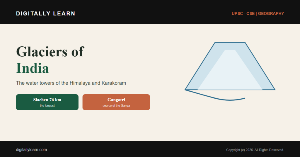
A glacier is a large mass of ice formed where, year after year, more snow falls than melts. The snow is buried, compacted and recrystallised into dense ice, which then flows slowly downhill under its own weight. Glaciers are the largest store of fresh water on land after the polar ice sheets.
Each glacier has two zones divided by the equilibrium line: an accumulation zone above, where snow is gained, and an ablation zone below, where ice is lost by melting. At the lower end, the snout, the meltwater emerges as a stream that feeds a river, which is why glaciers matter far beyond the mountains.
India's glacier belt: the Karakoram and the Himalaya
India's glaciers lie in the high northern mountains: the Karakoram in Ladakh and the Greater Himalaya running from Himachal Pradesh and Uttarakhand through Sikkim. These ranges hold thousands of glaciers, among the most extensive ice outside the polar regions.
This ice is the source of India's great perennial rivers. The Indus, the Ganga and the Brahmaputra all draw on Himalayan snow and glacier melt, which is why the range is often called the water tower of Asia.
The major glaciers of India
Siachen: the largest, in the eastern Karakoram
The Siachen Glacier is the largest glacier in India and, at 76 kilometres long, the longest in the Karakoram and the second-longest in the world's non-polar areas. It lies in the eastern Karakoram in Ladakh, falling from about 5,753 metres at Indira Col to roughly 3,620 metres at its terminus.
Its meltwater is the main source of the Nubra River, which drains into the Shyok and so into the Indus system. Lying along the high frontier, Siachen is also of considerable strategic importance to India.
Gangotri: the source of the Bhagirathi and the Ganga
The Gangotri Glacier in the Garhwal Himalaya of Uttarakhand is about 30 kilometres long and 2 to 4 kilometres wide, one of the largest in the central Himalaya. Its snout, known as Gaumukh, is the source of the Bhagirathi, an important tributary of the Ganges.
Because the Bhagirathi is a headstream of the Ganga, Gangotri carries both great hydrological and deep cultural significance, and Gaumukh is a major pilgrimage destination.
Other major glaciers and the rivers they feed
Several other glaciers are important both geographically and for the exam. The Bara Shigri, the largest in Himachal Pradesh, lies in the Chandra valley and feeds the Chandra, which becomes the Chenab. The Zemu, the largest in the Eastern Himalaya, sits at the base of Kangchenjunga in Sikkim and feeds the Teesta.
| Glacier | Location | River it feeds | River system |
|---|---|---|---|
| Siachen | Eastern Karakoram, Ladakh | Nubra, then Shyok | Indus |
| Gangotri | Garhwal Himalaya, Uttarakhand | Bhagirathi | Ganga |
| Bara Shigri | Chandra valley, Himachal Pradesh | Chandra, then Chenab | Indus |
| Milam | Pithoragarh, Uttarakhand | Goriganga | Ganga |
| Bandarpunch | Garhwal Himalaya, Uttarakhand | tributaries of the Yamuna | Ganga |
| Zemu | Kangchenjunga, Sikkim | Teesta | Brahmaputra |
Knowing these pairings matters: the Milam feeds the Goriganga, not the Mandakini, and the Zemu feeds the Teesta, not the Manas. UPSC has asked candidates to match glaciers with the rivers they feed, so the glacier and its river basin must be learnt together.
Glaciers as India's water towers
Why the perennial rivers depend on glacier melt
The northern rivers are perennial, flowing all year, precisely because they are fed by snow and glacier melt as well as by rain. When the monsoon has ended and there is no rain, it is the steady melt of Himalayan ice that keeps the Indus, the Ganga and the Brahmaputra flowing through the dry months.
This is the crucial contrast with the rivers of peninsular India, which are rain-fed and shrink sharply in the dry season. Glacier melt gives the northern plains a dependable, year-round water supply that the peninsula lacks.
Seasonal storage: nature's frozen reservoir
Glaciers act as a natural reservoir. They lock up the heavy winter snowfall as ice and release it slowly as meltwater through spring and summer, exactly when farms and towns need water most. In effect, the mountains store water in one season and hand it back in another.
Hundreds of millions of people across the Indo-Gangetic plain depend on this rhythm for drinking water, for the irrigation that underpins their agriculture, and for hydropower. The timing of glacier melt is therefore woven into the daily life of northern India.
Glacier retreat and climate change
How fast India's glaciers are retreating
Most Himalayan glaciers are now retreating as the climate warms, their snouts melting back faster than fresh snow can replace them. The Gangotri is the best-measured case: between 1936 and 1996 its snout retreated about 1,147 metres, an average of 19 metres a year.
In recent decades that retreat has accelerated, to roughly 34 metres a year. Warmer air, and soot or black carbon settling on the ice and making it absorb more heat, are driving the loss, although the rate varies from glacier to glacier.
Glacial lake outburst floods and downstream hazard
Retreat does not only shrink the ice; it creates a new hazard. As a glacier pulls back it often leaves a lake dammed behind a ridge of loose rock and debris called a moraine. If that natural dam fails, the lake empties in minutes as a glacial lake outburst flood, or GLOF.
A GLOF sends a wall of water and debris down the valley, threatening settlements, roads, bridges and hydropower dams far below. As warming forms more and larger glacial lakes, the Himalayan states face a rising flood risk that demands monitoring and early warning.
The impact of melting on India's water security
The far-reaching impact on water resources
The melting of Himalayan glaciers reshapes India's water resources in two stages. In the short term, faster melt swells river flows and brings more floods and outburst events. In the long term, as the ice that feeds the rivers shrinks, the dependable dry-season flow falls.
That decline strikes at the heart of northern India: less reliable water for irrigation, for hydropower and for the drinking supply of the densely settled plains, with direct consequences for agriculture and food security. Because the Indus and the Brahmaputra are shared with neighbours, the stakes are also transboundary, which is why glacier health is a national water-security question.
Monitoring and conserving the cryosphere
India studies its glaciers through several bodies. The Geological Survey of India maintains the national glacier inventory, the Wadia Institute of Himalayan Geology researches glacier behaviour, and satellites operated through ISRO track the ice from space.
Policy runs through the National Mission for Sustaining the Himalayan Ecosystem, one of the missions under the National Action Plan on Climate Change. Alongside it, early-warning systems for outburst floods and careful watershed management are the practical tools for living with a shrinking cryosphere.
How glaciers appear in the UPSC exam
Prelims pairings and Mains water-security angles
For Prelims, the favourite trap is the glacier-and-river match, so learn each major glacier with its range, its state and the river it feeds. The points worth fixing in memory are few and high-yield.
- Siachen is India’s longest glacier, in the eastern Karakoram, feeding the Nubra (Indus system).
- Gangotri, in Uttarakhand, is the source of the Bhagirathi and so of the Ganga.
- Bara Shigri is the largest glacier in Himachal Pradesh and feeds the Chenab.
- Zemu, the largest in the Eastern Himalaya, feeds the Teesta, not the Manas.
For Mains, the recurring demand is the impact of melting on water resources. A strong answer moves from the water-tower role of the glaciers, through their retreat, to the short-term flood and long-term scarcity effects on irrigation, hydropower and the plains, exactly the chain this article develops.
Prelims MCQ practice
Each question below tests one specific concept on the topic. Click to reveal the answer and a full option-wise explanation.
Q1. The longest glacier in India is the:
- Gangotri Glacier
- Siachen Glacier
- Zemu Glacier
- Bara Shigri Glacier
Show answer and explanation
Answer: Siachen Glacier
Explanation.
The Siachen Glacier, about 76 km long in the eastern Karakoram, is India's longest glacier and the longest in the Karakoram. Hence (b).
Q2. The Gangotri Glacier is the source of which river?
- Alaknanda
- Bhagirathi
- Mandakini
- Yamuna
Show answer and explanation
Answer: Bhagirathi
Explanation.
The snout of the Gangotri Glacier, Gaumukh, is the source of the Bhagirathi, an important headstream of the Ganga. Hence (b).
Q3. With reference to glaciers in India, consider the following statements:
- The Siachen Glacier lies in the eastern Karakoram range.
- The Bara Shigri is the largest glacier in Himachal Pradesh.
- The Zemu Glacier in Sikkim feeds the Manas River.
Which of the statements given above is/are correct?
- 1 and 2 only
- 2 and 3 only
- 1 and 3 only
- 1, 2 and 3
Show answer and explanation
Answer: 1 and 2 only
Explanation.
Statements 1 and 2 are correct. Statement 3 is wrong: the Zemu Glacier feeds the Teesta, not the Manas. Hence 1 and 2 only.
Q4. The Himalayan rivers are perennial mainly because they are fed by:
- monsoon rainfall alone
- snow and glacier melt as well as rain
- groundwater springs only
- lakes and reservoirs
Show answer and explanation
Answer: snow and glacier melt as well as rain
Explanation.
Glacier and snow melt sustains flow in the dry season when there is no rain, which is why the northern rivers are perennial, unlike the rain-fed peninsular rivers. Hence (b).
Q5. A glacial lake outburst flood (GLOF) is best described as:
- a flood caused by heavy monsoon rain
- the sudden release of water from a moraine-dammed glacial lake
- the seasonal melting of a glacier snout
- a flood caused by a river changing course
Show answer and explanation
Answer: the sudden release of water from a moraine-dammed glacial lake
Explanation.
A GLOF occurs when the natural moraine dam holding back a glacial lake fails, releasing the water suddenly as a destructive flood downstream. Hence (b).
Q6. Consider the following statements about Himalayan glaciers:
- Most Himalayan glaciers are retreating as the climate warms.
- The Gangotri Glacier has retreated faster in recent decades than in the mid-twentieth century.
- Glacier melt is unimportant for the dry-season flow of the Ganga.
Which of the statements given above is/are correct?
- 1 and 2 only
- 2 and 3 only
- 1 and 3 only
- 1, 2 and 3
Show answer and explanation
Answer: 1 and 2 only
Explanation.
Statements 1 and 2 are correct. Statement 3 is wrong: glacier melt is vital for the dry-season flow of the Ganga and the other northern rivers. Hence 1 and 2 only.
Sources and Further Reading
Editorial Disclaimer
This article explains the glaciers of India for UPSC preparation, drawing on standard earth-science and government sources. Names, lengths and figures reflect the cited authorities.


