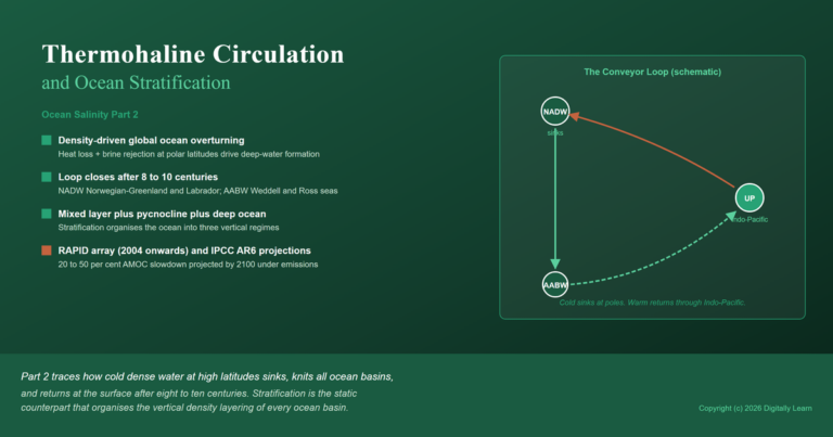

Overview
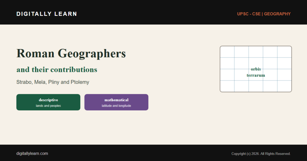
The Roman geographers were the scholars who described and mapped the known world during the Roman period. They include the Latin writers Pomponius Mela and Pliny the Elder and the Greek scholars Strabo and Ptolemy, who worked under Rome. Between them they produced descriptive regional geography, the encyclopaedic survey, the mathematical grid of latitude and longitude, and the practical road maps of the empire.
Geography in the Roman World
The Roman Approach to Geography
The Romans inherited the geography of the Greeks and turned it to their own ends. Where Greek scholars had often pursued geography as a mathematical science, the Roman temper was more practical, bent on description, survey and the needs of an empire.
Their geography therefore leaned towards regional description, the survey of provinces and the mapping of roads. It is best read as a body of work produced across the Roman period, by Latin writers and by Greek scholars living under Rome.
Why the Roman Geographers Matter
Why it matters is that these scholars gathered the scattered knowledge of the ancient world into lasting works. They fixed what was known of the Earth at the height of the classical age and handed it on to the centuries that followed.
For the student of geographical thought, they form a vital link in the long chain that runs from the Greeks, through Rome and the Arab geographers, to the modern subject. Their names recur in every account of how geography grew.
The Latin Geographers of Rome
Pomponius Mela, the First Roman Geographer
Pomponius Mela, who wrote around AD 43, is regarded as the earliest known Roman geographer. His short work, De situ orbis, was the first formal geography written in Latin.
Following the Greeks, Mela divided the Earth into five zones, of which he held only two to be habitable, and he described the known world across the three parts of Europe, Asia and Africa.
Pliny the Elder and the Natural History
Pliny the Elder, who lived from about AD 23 to AD 79, gathered the knowledge of his age into the Naturalis Historia, a great encyclopaedic work of thirty-seven books that is often called the first encyclopaedia.
Several of its books survey the geography of the Roman world, province by province. Pliny himself died in AD 79 in the eruption of Mount Vesuvius, while trying to observe it and rescue those in its path.
The Greek Geographers of the Roman Period
Strabo and the Geographica
Strabo, who lived from about 64 BC to AD 24, was a Greek geographer and historian of Asia Minor who wrote during the rise of the Roman Empire. His Geographica, in seventeen books, is the great descriptive geography of the classical world.
It is the only surviving work to describe both Greek and Roman lands in the age of Augustus. Strabo held that a descriptive approach was the more useful, writing above all for the statesman who needed to know the character of countries.
Ptolemy and Mathematical Geography
Claudius Ptolemy, who worked at Alexandria in Roman Egypt around AD 150, carried geography towards an exact science. In his Geography he set out to fix the position of places by latitude and longitude.
He compiled a catalogue of some eight thousand places, gave coordinates to thousands of them on a grid that spanned the globe, and discussed how to project the round Earth onto a flat map. His work shaped cartography for many centuries.
Roman Practical Geography and Cartography
Itineraries and the Peutinger Table
Rome's most distinctive contribution was its practical mapping. The empire was bound together by roads, and the Romans recorded them in itineraries, lists of stations and the distances between them along each route.
From such itineraries came the famous Tabula Peutingeriana, an illustrated road map of the whole network. It strings together more than five hundred cities in a schematic form, like a modern transit map, made to guide travel rather than to show the true shape of the land.
Surveying, Roads and the Needs of Empire
Roman geography served the state. Surveyors laid out roads, camps and colonies, and the administration needed to know the extent and resources of its provinces.
This practical bent gave Roman work its strength and its limit. It excelled at the description and mapping of the known world, but it added less than the Greeks had to the theory of the Earth as a whole.
The Significance and Legacy
What the Roman Geographers Contributed
Taken together, the Roman-period geographers gave geography four lasting gifts. They perfected the descriptive, regional account of lands and peoples, above all in Strabo, and they raised mathematical mapping to a science in Ptolemy.
They gathered the world into great encyclopaedic surveys, as Pliny did, and they pioneered the practical road map for travel and rule. In doing so they preserved and organised the geography of the ancient world.
The Bridge to Later Geography
The Roman achievement did not end with Rome. Ptolemy's Geography, in particular, was carried into the Arab world and later recovered in Europe, where it guided the mapmakers of the age of exploration.
Through these works the learning of the classical world was passed on. The Roman geographers thus stand as the bridge between Greek geography and the geographies of the medieval and modern ages.
The Roman Geographers in the UPSC Exam
The Wider Significance for Geographical Thought
What is the significance of the Roman geographers is that they mark a distinct stage in the history of geographical thought. They show geography turning from pure theory towards description, survey and practical mapping.
| Geographer | Major work | Key contribution |
|---|---|---|
| Strabo (Greek) | Geographica | descriptive, regional geography for statesmen |
| Pomponius Mela (Latin) | De situ orbis | the first Roman geography; the five zones |
| Pliny the Elder (Latin) | Naturalis Historia | an encyclopaedic survey of the known world |
| Ptolemy (Greek) | Geography | latitude and longitude, a grid and projections |
For the exam, the episode is a compact study of how a civilisation records and maps its world, and of the difference between descriptive and mathematical geography.
Placing Them in the History of Geography
Contemporary linkages run from these scholars to the geography of today. The latitude and longitude grid we still use was set out by Ptolemy, and the idea of a route map survives in every modern atlas and transit chart.
Placed in the long story of the subject, the Roman geographers sit between the Greeks and the Arab geographers who followed. The high-yield points are few and worth holding in mind.
- Pomponius Mela was the first Roman (Latin) geographer; his De situ orbis divided the Earth into five zones.
- Strabo’s Geographica gave a descriptive, regional account of the known world.
- Ptolemy’s Geography fixed places by latitude and longitude on a grid and discussed map projections.
- Pliny the Elder’s Naturalis Historia was an encyclopaedic survey of the Roman world.
- Roman maps, such as the Peutinger Table, were practical route guides built from itineraries.
Prelims MCQ practice
Each question below tests one specific concept on the topic. Click to reveal the answer and a full option-wise explanation.
Q1. Who among the following is regarded as the earliest known Roman (Latin) geographer?
- Pomponius Mela
- Strabo
- Ptolemy
- Eratosthenes
Show answer and explanation
Answer: Pomponius Mela
Explanation.
Pomponius Mela, who wrote around AD 43, was the earliest known Roman geographer; his De situ orbis was the first geography in Latin. Strabo and Ptolemy wrote in Greek; Eratosthenes was an earlier Greek. Hence (a).
Q2. The 17-book descriptive work Geographica, the great geography of the classical world in the age of Augustus, was written by:
- Strabo
- Pliny the Elder
- Pomponius Mela
- Herodotus
Show answer and explanation
Answer: Strabo
Explanation.
Strabo's Geographica, in seventeen books, is the great descriptive geography of the classical world and the only surviving work to describe both Greek and Roman lands in the age of Augustus. Hence (a).
Q3. With reference to Claudius Ptolemy's contribution to geography, consider the following statements:
- He fixed the position of places using latitude and longitude on a grid.
- He compiled a catalogue of thousands of places with coordinates.
- He worked mainly at Alexandria in Roman Egypt.
Which of the statements given above is/are correct?
- 1 and 2 only
- 2 and 3 only
- 1 and 3 only
- 1, 2 and 3
Show answer and explanation
Answer: 1, 2 and 3
Explanation.
All three are correct: Ptolemy worked at Alexandria in Roman Egypt and, in his Geography, fixed places by latitude and longitude, cataloguing thousands with coordinates on a grid. Hence 1, 2 and 3.
Q4. The encyclopaedic work Naturalis Historia, several of whose books survey the geography of the Roman world, was written by:
- Pliny the Elder
- Pomponius Mela
- Strabo
- Ptolemy
Show answer and explanation
Answer: Pliny the Elder
Explanation.
Pliny the Elder's Naturalis Historia, a thirty-seven-book encyclopaedia, surveys the geography of the Roman world; he died in the eruption of Vesuvius in AD 79. Hence (a).
Q5. Consider the following statements about the Tabula Peutingeriana (the Peutinger Table):
- It is a schematic Roman road map showing the routes and stations of the empire.
- It is drawn to an accurate geographic scale showing the true shape of the land.
Which of the statements given above is/are correct?
- 1 only
- 2 only
- Both 1 and 2
- Neither 1 nor 2
Show answer and explanation
Answer: 1 only
Explanation.
Statement 1 is correct: the Peutinger Table is a schematic road map of the Roman network. Statement 2 is wrong: it is deliberately schematic, like a transit map, not drawn to true geographic scale. Hence 1 only.
Q6. Which one of the following best describes the general character of geography in the Roman period as compared with the earlier Greek tradition?
- More practical, descriptive and concerned with mapping and administration
- More purely theoretical and mathematical
- Concerned only with astronomy and the heavens
- Focused entirely on the geography of India
Show answer and explanation
Answer: More practical, descriptive and concerned with mapping and administration
Explanation.
Roman-period geography was more practical and descriptive, concerned with regional description, surveying and the mapping of roads for administration, in contrast to the more mathematical Greek tradition. Hence (a).
Sources and Further Reading
Editorial Disclaimer
This article explains the contributions of the Roman geographers for UPSC preparation, drawing on standard historical and geographical sources. Names, dates and works reflect the cited authorities.