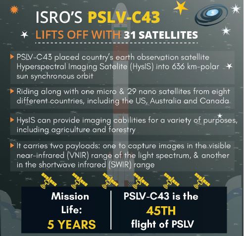
ISRO’s PSLV C43 launched India’s first Hyperspectral Imaging Satellite (HysIS) along with 30 foreign satellites from Satish Dhawan Space Centre, Sriharikota.
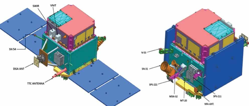
Hyperspectral Imaging Satellite (Hysis) is an earth observation satellite built around ISRO’s Mini Satellite-2 (IMS-2) bus.
About the Hyperspectral Imaging Technology | UPSC – IAS
It combines the power of digital imaging and spectroscopy to attain both spatial and spectral information from an object.
This result can be then used to identify, measure and locate different materials and their chemical and physical properties. Every pixel in the image contains a continuous spectrum (in radiance or reflectance) and can be used to characterize the objects in the scene with great precision and detail.
Hyperspectral images provide much more detailed information about the scene by dividing the spectrum into many more bands than a normal color camera, which only acquires three different spectral channels corresponding to the visual primary colors red, green and blue.
It was first tried by ISRO in an experimental satellite in May 2008 and later on Chandrayaan-1 mission for mapping lunar mineral resources, this is the first time a full-fledged hyperspectral imaging satellite (Hysis) has been launched.
Application of Hyperspectral Remote Sensing Isro | UPSC – IAS
Hyperspectral remote sensing is used for a range of applications like agriculture, forestry, soil survey, geology, coastal zones, inland water studies, environmental studies, detection of pollution from industries and the military for surveillance or anti-terror operations.
Other utilities include online industrial monitoring/sorting/classification to laboratory measurements, clinical instruments for medical diagnostic and airborne and satellite based remote sensing tools.
Challenges: This technology is accompanied with high cost and complexity. There is a need for fast processing of data (fast computers), sensitive detectors and large data storage capacities for hyperspectral imaging data.
Key – Terms | related to Hyperspectral imaging satellite (Hysis) (UPSC – IAS)
Polar Sun-Synchronous orbit
It is a nearly polar orbit around a planet, in which the satellite passes over any given point of the planet’s surface at the same local mean solar time.
Geosynchronous orbit
It is an orbit around Earth of a satellite with an orbital period that matches Earth’s rotation on its axis, which takes one sidereal day.
Geostationary orbit
It is a circular geosynchronous orbit 35,786 km (22,236 mi) above Earth’s equator and following the direction of Earth’s rotation.
What is Spectral Imaging ? (Isro)
It is imaging that uses multiple bands across the electromagnetic spectrum like using infrared, the visible spectrum, the ultraviolet, x-rays, or some combination of the above.
hyperspectral imaging vs multi spectral imaging
The main difference between multispectral and hyperspectral is the number of bands and how narrow the bands are.
Hyperspectral imaging (HSI) uses continuous and contiguous ranges of wavelengths (e.g. 400 – 1100 nm in steps of 0.1 nm) whilst multispectral imaging (MSI) uses a subset of targeted wavelengths at chosen locations (e.g. 400 – 1100 nm in steps of 20 nm).
Hyperspectral imagery consists of much narrower bands (10-20 nm). A hyperspectral image could have hundreds or thousands of bands. In general, it comes from an imaging spectrometer.


 Project | UPSC - IAS")

